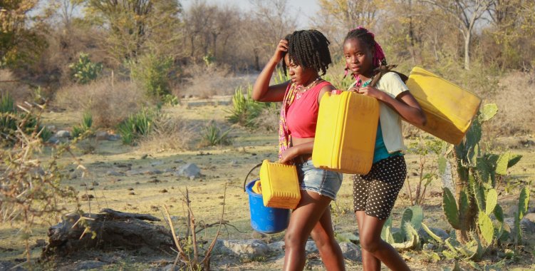
"In order to improve the response capacity to the impacts of agricultural drought, the Government of Angola, through a collaborative initiative between the National Institute of Meteorology and Geophysics (INAMET) under the Ministry of Telecommunications, Information Technologies and Social Communication (MINTTICS), the Ministry of the Environment (MINAMB) and the Ministry of Agriculture and Forestry (MINAGRIF), is since January 2021 engaged in the implementation of an Agricultural Drought Monitoring System in Angola called the Agricultural Water Stress Index System (ASIS)", informs MINTTICS, in a statement to which VerAngola had access.
The guardianship advances that currently the implementation process of this initiative - framed "within the financing mechanism of the Green Climate Fund (GCF) and has the technical support of the Food and Agriculture Organization of the United Nations (FAO)" - is in the final straight line of calibration.
"Right now, the ASIS implementation process at national level is in its final calibration phase, where the tool is being adapted to local conditions and to the level of administrative units of municipalities across the country", reads in the note.
In this sense, adds the statement, "a specialized inter-institutional technical team, composed of representatives of INAMET/MINTTICS and MINAGRIF" is monitoring the process that will culminate "with the installation of the ASIS tool on the INAMET Server and later its launch in a national workshop, scheduled for the first half of September 2023".
According to the statement, ASIS aims to produce information that will enable Angola to "monitor agricultural drought and manage" its risks, using "satellite data to detect cultivated areas that may be affected by drought". Through this system, "it is possible to monitor the vegetation indexes in the areas of cultivation during the phenological phases through the detection of critical points, also called 'hotspots' in zones where the cultures can be affected by the drought".
The ASIS, says the guardianship, is based on the Vegetation Health Index that derives from the Vegetation Index by Normalized Difference, which indirectly measures "primary production through its relationship with photosynthetically active radiation".
Thus, "from the point of view of end users, the results produced through this tool are specifically intended to support decision makers in monitoring agricultural droughts in order to assist in risk management in the event of the occurrence of the drought phenomenon agriculture", the communiqué also states.